Precision in every pixel

Transforming Canada’s Utility Networks

We plan, design, permit, and validate utility infrastructure—specializing in telecommunications networks and LiDAR-powered vegetation management. End-to-end delivery. Utility-grade quality. Safety without compromise.

Who we serve

Built for Canadian Utilities & Broadband

0 K+ km

Corridor data captured

0 %

Permit approval on first pass

30 -50%

Fewer field revisits

0 %

Safety-focused delivery

Why Powertek

Integrated Utility Expertise One Accountable Partner

End-to-end delivery

From feasibility and route selection to detailed engineering, permitting, construction support, and as-builts.

Safety & quality assured

Utility-grade QA/QC, traceable decisions, and a safety-first culture keep people, assets, and schedules protected.

Data-driven decisions

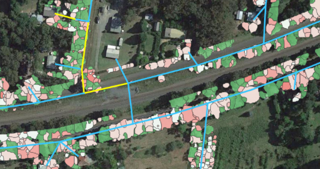
Mobile LiDAR, GIS, and cloud deliverables reduce re-visits, accelerate approvals, and keep stakeholders aligned.

LiDAR Vegetation Management

Proven process for utility-grade outcomes

01

Discover & Scope

Define goals, constraints, and data needs which Align schedules, risks, and success metrics.

02

Model & Design

Create digital corridors, run engineering checks, and iterate constructability with stakeholders.

03

Permit & Mobilize

Submit complete packages, secure approvals, and set up field QA/QC and safety plans.

04

Assure & Close

Inspect builds, capture as-builts, and hand over final GIS records with audit trails.

Services

What We Do Best

Telecommunications

Network Planning, Engineering & Permitting

Complete telecom delivery across Canada—FTTx, transport/backbone, 5G wireline support, and joint-use attachments for aerial and underground builds.

LiDAR Vegetation Management

Mobile LiDAR, Analytics & Remediation Planning

Point-cloud accuracy with high-resolution imagery enables precise clearance assessment, risk ranking, and targeted vegetation work—reducing truck rolls and outages.
Technology

Modern Geospatial & Engineering Stack

Mobile LiDAR + Imagery

Corridor-scale capture with 360° imagery delivers measurement-ready point clouds for design, vegetation, and asset condition assessment.

  • Cloud viewers & hyperlinked imagery
  • 2D/3D CAD conversion & redlines
  • Data layers for engineering & operations

GIS & Collaboration

Hosted maps and dashboards keep utilities, municipalities, and EPC partners aligned—accelerating decisions and improving compliance.

  • Asset management & capital planning inputs
  • Outage & network operations context
  • Audit-ready records for regulators

Client Testimonials

“A testimonial from a client who benefited from your product or service. Testimonials can be a highly effective way of establishing credibility and increasing your company's reputation.”
Client Name
“A testimonial from a client who benefited from your product or service. Testimonials can be a highly effective way of establishing credibility and increasing your company's reputation.”
Client Name
“A testimonial from a client who benefited from your product or service. Testimonials can be a highly effective way of establishing credibility and increasing your company's reputation.”
Client Name